Maksud perkataan "geographic information system" dalam bahasa Melayu
Apakah maksud "geographic information system" dalam bahasa Inggeris? Terokai maksud, sebutan dan penggunaan khusus perkataan ini bersama Lingoland
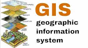
geographic information system
US /ˌdʒiː.əˈɡræf.ɪk ɪn.fɚˌmeɪ.ʃən ˈsɪs.təm/
UK /dʒiː.əˈɡræf.ɪk ɪn.fəˈmeɪ.ʃən ˈsɪs.təm/
Kata Nama
sistem maklumat geografi
a system designed to capture, store, manipulate, analyze, manage, and present all types of geographical data
Contoh:
•
We used a geographic information system to map the distribution of endangered species.
Kami menggunakan sistem maklumat geografi untuk memetakan taburan spesies terancam.
•
Understanding a geographic information system is crucial for urban planning.
Memahami sistem maklumat geografi adalah penting untuk perancangan bandar.
Sinonim:
Kata Berkaitan: