"geographic information system" kelimesinin Türkçe anlamı
"geographic information system" İngilizce'de ne anlama geliyor? Lingoland ile bu kelimenin anlamını, telaffuzunu ve özel kullanımını keşfedin
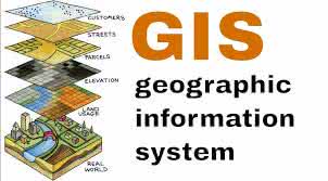
geographic information system
US /ˌdʒiː.əˈɡræf.ɪk ɪn.fɚˌmeɪ.ʃən ˈsɪs.təm/
UK /dʒiː.əˈɡræf.ɪk ɪn.fəˈmeɪ.ʃən ˈsɪs.təm/
İsim
coğrafi bilgi sistemi
a system designed to capture, store, manipulate, analyze, manage, and present all types of geographical data
Örnek:
•
We used a geographic information system to map the distribution of endangered species.
Tehlike altındaki türlerin dağılımını haritalamak için bir coğrafi bilgi sistemi kullandık.
•
Understanding a geographic information system is crucial for urban planning.
Bir coğrafi bilgi sistemini anlamak, şehir planlaması için çok önemlidir.
Eş Anlamlı:
İlgili Kelime: