ความหมายของคำ "geographic information system" ในภาษาไทย
"geographic information system" ในภาษาอังกฤษหมายถึงอะไร? มาร่วมค้นหาความหมาย การออกเสียง และวิธีใช้คำนี้อย่างละเอียดกับ Lingoland
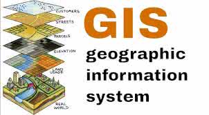
geographic information system
US /ˌdʒiː.əˈɡræf.ɪk ɪn.fɚˌmeɪ.ʃən ˈsɪs.təm/
UK /dʒiː.əˈɡræf.ɪk ɪn.fəˈmeɪ.ʃən ˈsɪs.təm/
คำนาม
ระบบสารสนเทศภูมิศาสตร์
a system designed to capture, store, manipulate, analyze, manage, and present all types of geographical data
ตัวอย่าง:
•
We used a geographic information system to map the distribution of endangered species.
เราใช้ระบบสารสนเทศภูมิศาสตร์เพื่อทำแผนที่การกระจายของสัตว์ใกล้สูญพันธุ์
•
Understanding a geographic information system is crucial for urban planning.
การทำความเข้าใจระบบสารสนเทศภูมิศาสตร์เป็นสิ่งสำคัญสำหรับการวางผังเมือง
คำพ้องความหมาย:
คำที่เกี่ยวข้อง: