Znaczenie słowa "geographic information system" po polsku
Co oznacza "geographic information system" po angielsku? Poznaj znaczenie, wymowę i specyficzne użycie tego słowa z Lingoland
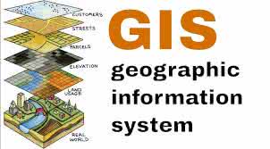
geographic information system
US /ˌdʒiː.əˈɡræf.ɪk ɪn.fɚˌmeɪ.ʃən ˈsɪs.təm/
UK /dʒiː.əˈɡræf.ɪk ɪn.fəˈmeɪ.ʃən ˈsɪs.təm/
Rzeczownik
system informacji geograficznej
a system designed to capture, store, manipulate, analyze, manage, and present all types of geographical data
Przykład:
•
We used a geographic information system to map the distribution of endangered species.
Użyliśmy systemu informacji geograficznej do mapowania rozmieszczenia zagrożonych gatunków.
•
Understanding a geographic information system is crucial for urban planning.
Zrozumienie systemu informacji geograficznej jest kluczowe dla planowania urbanistycznego.
Synonim:
Powiązane Słowo: