単語 "geographic information system" の日本語での意味
"geographic information system" は英語で何を意味しますか?Lingolandと一緒にこの単語の意味、発音、具体的な使い方を学びましょう
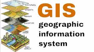
geographic information system
US /ˌdʒiː.əˈɡræf.ɪk ɪn.fɚˌmeɪ.ʃən ˈsɪs.təm/
UK /dʒiː.əˈɡræf.ɪk ɪn.fəˈmeɪ.ʃən ˈsɪs.təm/
名詞
地理情報システム
a system designed to capture, store, manipulate, analyze, manage, and present all types of geographical data
例:
•
We used a geographic information system to map the distribution of endangered species.
絶滅危惧種の分布をマッピングするために、地理情報システムを使用しました。
•
Understanding a geographic information system is crucial for urban planning.
地理情報システムを理解することは、都市計画にとって非常に重要です。
同義語: